Ultimate Interstates:High Desert Conceptual Corridor


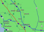
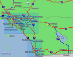
The High Desert Ultimate Interstate Corridor is a conceptual interstate highway corridor following along sections of CA-14; US-395 and US-6 connecting the Southern California (Los Angeles/San Diego) megapolitan area to Interstate 70, and Interstate 80 via a new Interstate 11 corridor. This would provide direct connections to many major intermountain cities including Reno, Boise, Salt Lake City, Denver and better connections to intermountain states such as Nevada, Idaho, Oregon, Utah, Montana, Wyoming and Colorado.
Routing
This conceptual corridor consists of two segments.
Segment One | Eastern Sierra Corridor
Segment one would begin at I-5 in the south following along the CA-14 Antelope Valley Freeway from Santa Clarita, CA and travelling northward through the Antelope Valley and connecting with planned I-40 extension north of Mojave, CA. It would continue north from there along CA-14 where it would eventually merge with the US-395 corridor and continue north through the Owens Valley and Bishop, CA. From there the corridor would then follow US-6 eastward until it reaches the planned Interstate 11 corridor near Coaldale, NV.
Segment Two | Great Basin Corridor
Segment two would continue east from there to Bishop and continue eastward along US-6 from Tonopah, NV traveling to Ely, NV and joining with the possible westward extension of I-70
Interstate Number Designation
Several options are possible for an interstate designation for the corridor:
I-70
Ultimately the interstate could be numbered as I-70 if the northern alternative for I-70 through Fallon and Fernley, NV are not chosen. Having I-70 end in Tonopah or Bishop could pave the way for a possible extension of I-70 over the central Sierras to serve the city of Fresno and the south bay.
I-13
The route could also be numbered as I-13 since it would be located west of Interstate 15 and would be mostly a north south corridor through the region. The route could be numbered as I-13 on just the first segment from Santa Clarita to I-11 or could be continued on to segment 2 to Ely. Choosing this number would allow the route to be extended northward from Ely to Twin Falls, ID following along the US-93 corridor.
I-62 or I-58
I-62 or I-58 is also a possibility for the eastern leg between Tonopah and Ely as well as it falls between I-70 and I-40 and would not be a primary interstate designation. There are other numbers that can be chosen that fall between I-40 and I-70.
Alternate Routings
Since the corridor is comprised of two segments they could be built or numbered independently, or just one or the other could be constructed based on traffic needs. Ultimately segment one (Eastern Sierra Corridor) makes more sense since it is a higher traffic corridor than segment two (US-6) and would connect southern california with the northwest and northern intermountain states very easily, especially if I-11 is built north of Las Vegas.
Purpose and Need
Segment One
Being along the east side of the Sierra range this route would connect many small cities together within Inyo, Mono and eastern Kern counties and open up opportunities to economic development along the corridor. Currently US-395 is one of America's great back roads and is very scenic with many natural resources, national parks and nature activities. Additionally having another north south corridor to compliment the existing interstate system and provide an inland route away from busier more congested central valley cities is desirable.
Segment Two
With the Nevada desert being relatively sparsely populated it does not make as much sense to build a 4 lane interstate along this segment unless there is an ultimate goal of creating a new corridor across the central Sierra Nevada range. Ultimately the need to build any corridor across these remote areas of the Great Basin would be to facilitate connections to I-80 or a new crossing of the Sierras.
Potential Auxiliary Routes
If built possible a possible auxiliary route (I-613) could be constructed to replace the lower section of US-395 from Ridgecrest, CA down to Victorville connecting with I-15 and I-40.
Plausibility
This corridor is an option for consideration to an ultimate western plan of the eventual buildout of the interstate system. While at this time the need is minimal over time the need for an interstate quality corridor along this section will become more iminent. However with that being said it is not as likely that we will see such a corridor for several decades.